Welcome to Panjin Shunsheng Petroleum Technology Co., Ltd.
‹
›
‹
›
Detection of Aeromagnetic Unexploded Bomb of UAV
Product introduction
Detection of Aeromagnetic Unexploded Bomb of UAV

Introduction of UAV Aeromagnetic Unexploded Bomb Detection Technology
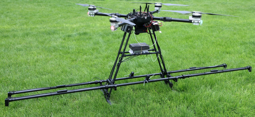
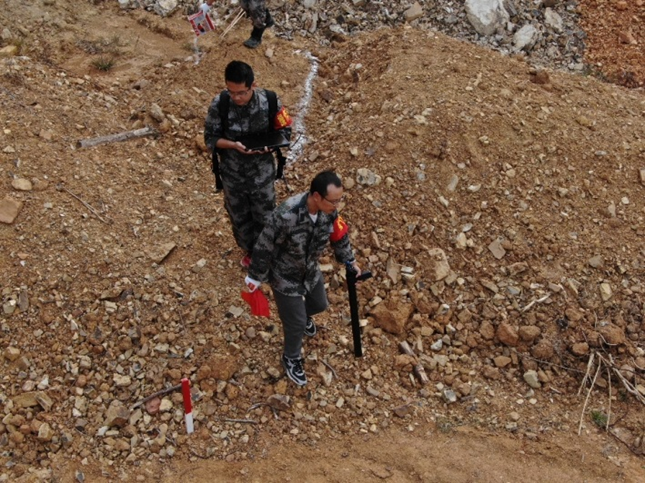
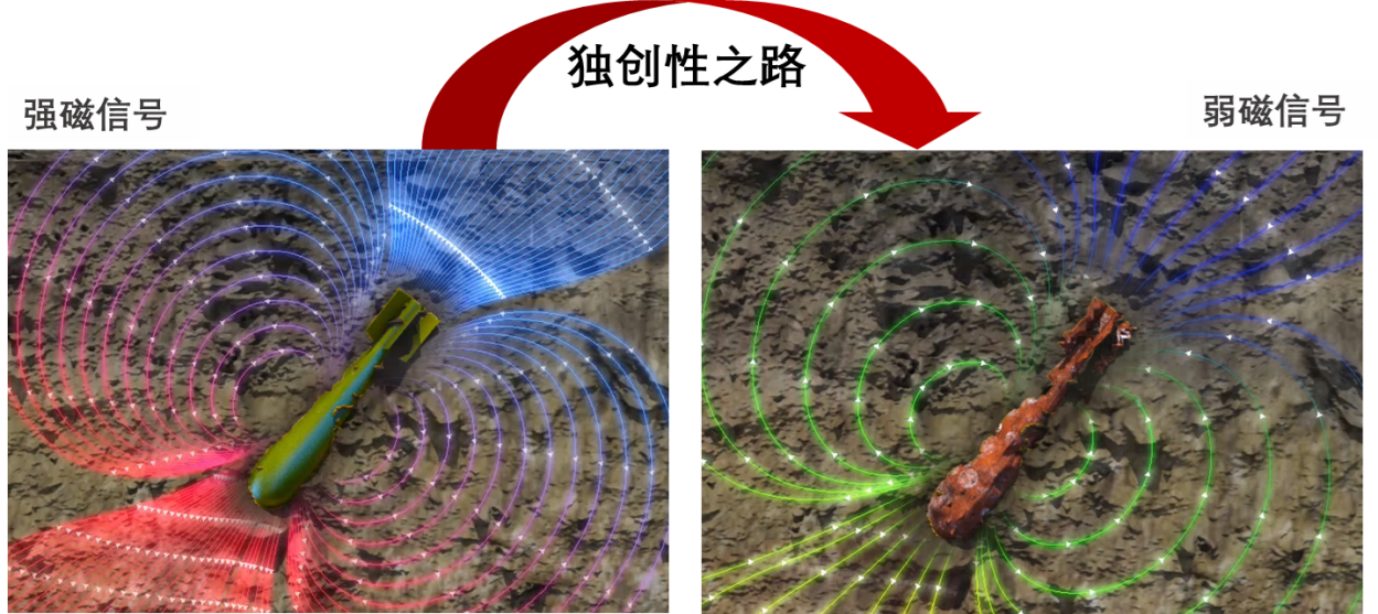
1. Technical Overview A UAV Aeromagnetic Unexploded Bomb Detection Technology According to the statistics of domestic detection data, most unexploded bombs in China are located within 5m below the surface, and almost all of them are magnetic. At present, domestic detection is mainly carried out by measuring the total magnetic field, and plane positioning is carried out by using the magnetic anomalies generated by unexploded bombs, but the conventional ground magnetic method works with low efficiency and great danger. At present, our company has achieved good results by using the aeromagnetic horizontal gradient measuring device of multi-rotor UAV to detect unexploded ordnance.
B Brief introduction of UAV's aeromagnetic unexploded ordnance detection method Step
1: Use UAV's 3D lidar to complete site scanning, and form an orthographic image of the detection area, 3D laser point cloud and high-precision digital elevation model (DEM). Step
2: Plan the ground-simulated route on the digital elevation model, with the line distance set to 1-5m, the flying height set to 1.5-5m above the ground and the sampling frequency set to 10Hz. The flight speed is set to 2-5m/s, and the plane positioning accuracy of RTK GPS is better than ±0.02m. Step
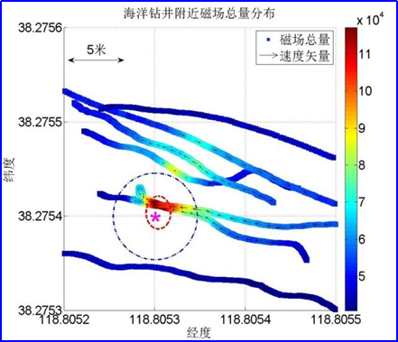
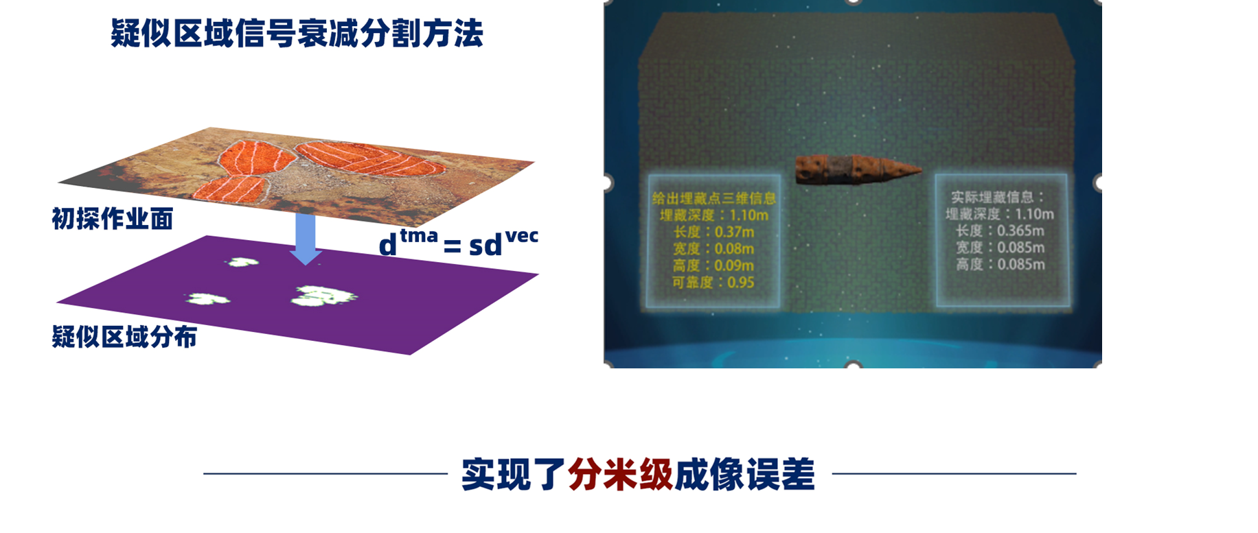
3: According to the pre-planned route, carry out high-precision aeromagnetic data acquisition of the UAV, and simultaneously carry out magnetic diurnal variation observation. After the data acquisition is completed, use analytical signal method to identify the position of unexploded ordnance, and use Euler three-dimensional inversion to calculate the approximate buried depth of unexploded ordnance. Step
4: Submit the UAV aeromagnetic △T isoline plan, aeromagnetic gradient analysis signal plan, orthophoto map of detection area, 3D laser point cloud data, list of inferred unexploded ordnance coordinates and other achievements, and put forward suggestions for the next step of ground excavation.
2, technical features A UAV aeromagnetic unexploded ordnance detection system technical features
1, based on the unified platform multi-load UAV three-dimensional lidar three-dimensional point cloud high-precision digital elevation model (DEM) automatic route planning can be quickly deployed, automatic flight can efficiently, accurately and unmanned collect magnetic gradient data.
2. The mature flight platform is equipped with RTK GPS, which can achieve stable flight and hovering with positioning accuracy better than 2cm. The six-way binocular vision and infrared sensing system enable the aircraft to detect obstacles in time, and the real-time data transmission can effectively monitor the system on the spot and process the data quickly.
3. The horizontal arrangement of aeromagnetic gradient double probes has good advantages in resisting the interference of complex magnetic environment, simplifying the daily variation processing and improving the horizontal spatial resolution of magnetic field.
4. The high-precision double optical pump probe and the vector fluxgate probe cooperate with each other to realize the automatic real-time compensation of the aeromagnetism of the rotorcraft, and better remove the magnetic interference of the platform.
5. Mature data processing methods can quickly obtain the horizontal information of magnetic field gradient data, and quickly inverse the buried position of underground unexploded ordnance, and the data signal-to-noise ratio is high.

3. Application Case
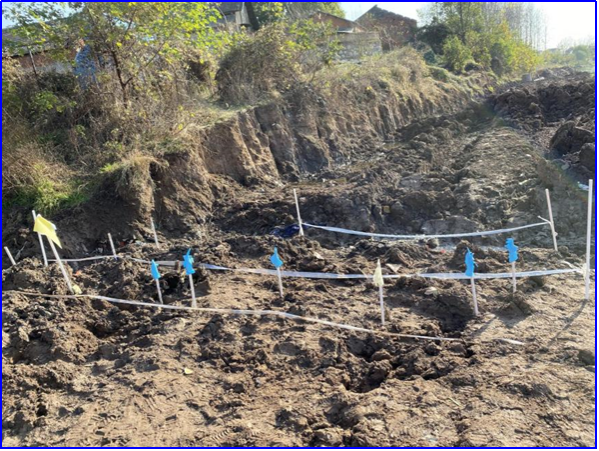
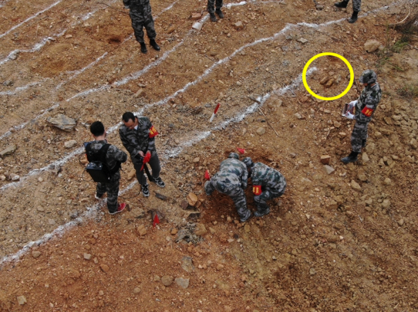
A. Unexploded Bomb and Mine Detection Test in Farmland On December 2,
2019, Dangyang, Hubei Province, medium conditions: silt, terrain: relatively flat target buried depth distribution: 0.2-4m Target type: unexploded bomb.
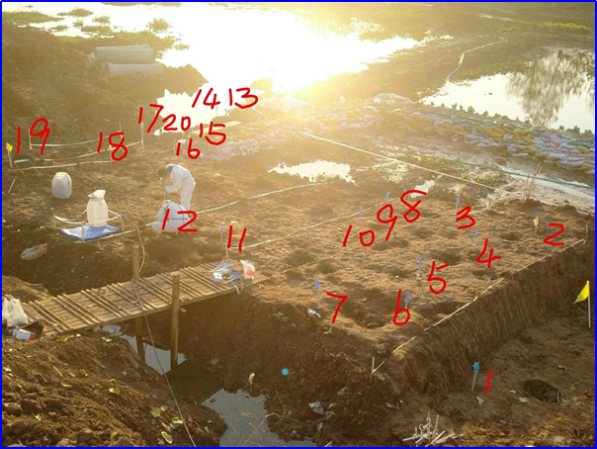
On November 7, 2019, Wuhan, Hubei Province, medium conditions: loess terrain: steep slope target depth distribution: 0.2-2m Target types: grenades, shells and bullets.
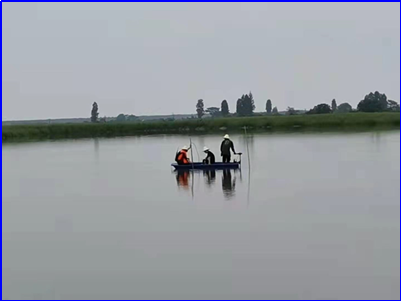
On June 2, 2021, Nanchang, Jiangxi Province, medium conditions: silt topography: target depth distribution of ponds: water depth of 1-2.5m, underwater silt depth of 0.2-1m; target type: electromagnetic projectile.
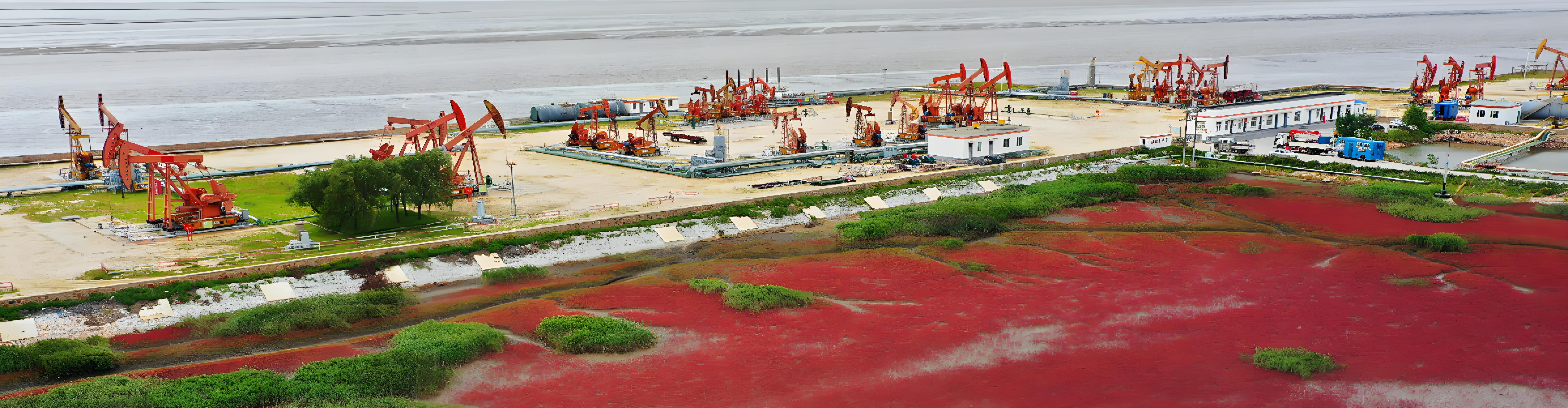
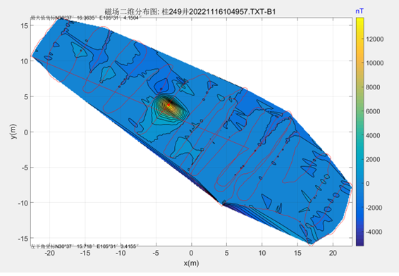
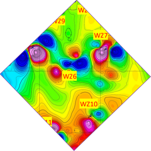
Location of buried wellhead
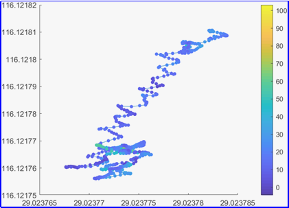
On November 16th, 2022, Deyang, Sichuan Province searched for multiple buried wellhead locations.

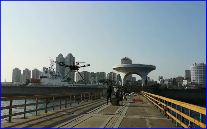
On April 7, 2020, Dongying, Shandong Province, medium conditions: seabed topography: offshore target buried depth distribution: water depth 20m, underwater silt buried depth: 3-6m, target type: wellhead.